Biologging & Argos Tags
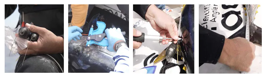
Technology Serving the Ocean: Biologging To solve the mystery of these migrations, scientists use biologging, a technique that involves equipping animals with smart electronic tags. The ARGOS Satellite System The tags used, called Argos tags, are true onboard computers:
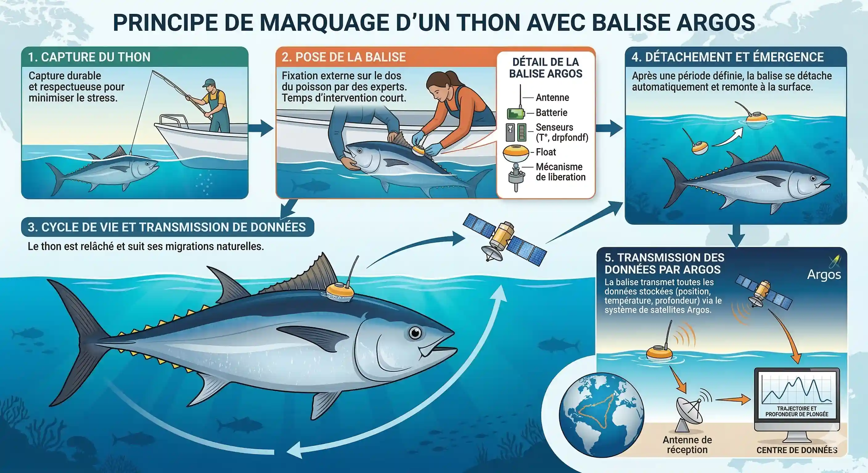
Illustration of satellite tracking via ARGOS tag
- Recording: For approximately one year, the tag records depth, water temperature, and light levels.
- Automatic release: At a programmed date, the tag detaches from the fish and floats to the surface.
- Transmission: Once floating, it transmits its data to Argos satellites.
- Analysis: An algorithm then reconstructs the precise underwater trajectory of the tuna.
POP-UP Tag
Records temperature, light, and depth for approximately 1 year.
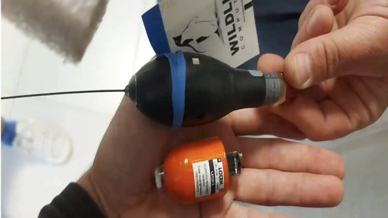
Satellite Transmission
Surfaces to transmit data via satellite.
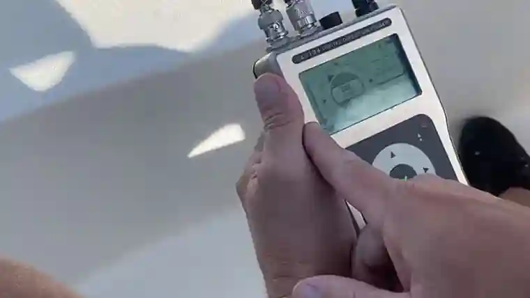
Goniometry
MTR is certified to locate and recover tags at sea (value €12,500).
Participatory and Responsible Science The strength of the Mission Thon Rouge lies in the involvement of expert recreational fishermen.
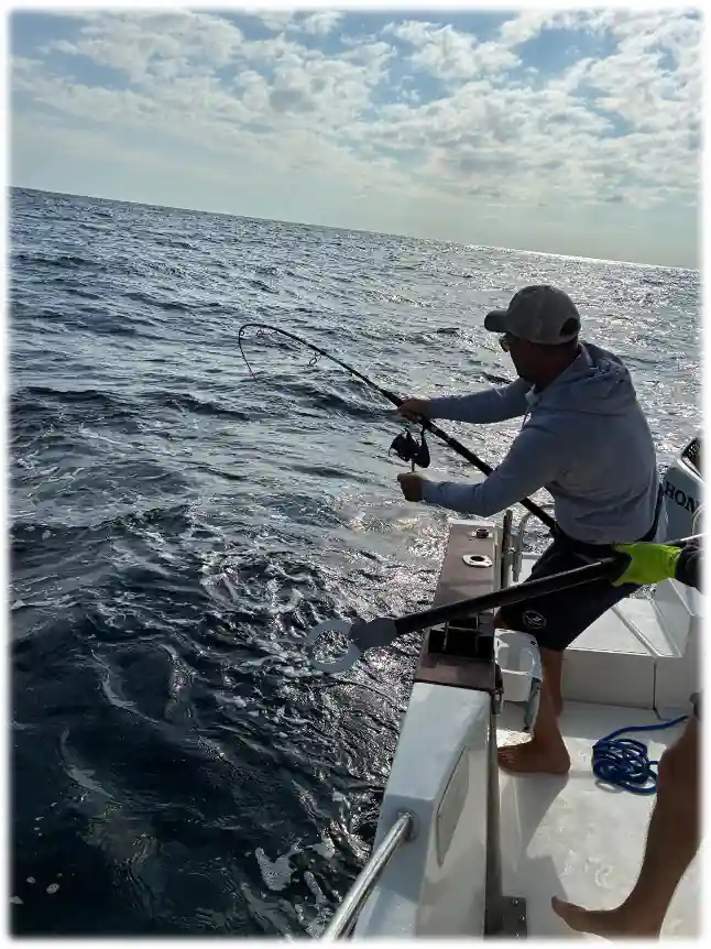
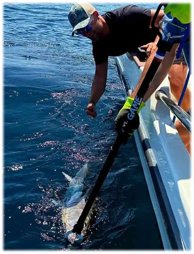
- Fishing protocol: Only rod and reel fishing is used, as it is considered the safest for the survival of the fish.
- Capture and Release ("Catch & Release"): The goal is not capture, but tagging. The fish is brought alongside, equipped with its tag, and sampled for DNA in less than 2 minutes before being released.
- Animal welfare: Rigorous protocols validated by ICCAT (International Commission for the Conservation of Atlantic Tunas) guarantee maximum survival of individuals.
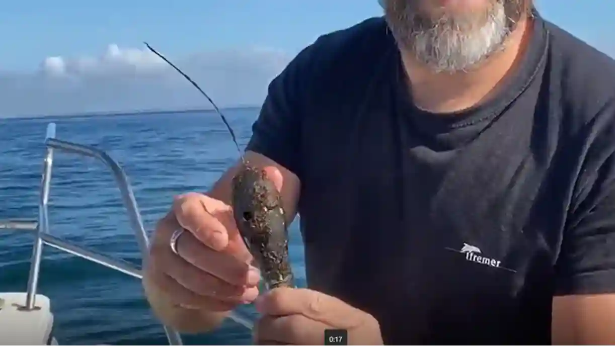
Tuna tagging - MTR
Video: Bluefin tuna tagging demonstration by IFREMER
Concrete Results for the Future In 2025, the tagging days in Royan were a total success: 20 tuna were tagged and released in just two days. These data allow for:
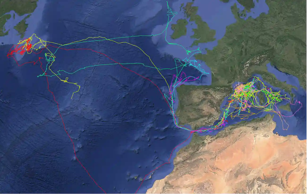
Tuna tracking via ARGOS tag
- Mapping migratory routes with unprecedented precision (some tags revealed journeys of over 12,000 nautical miles).
- Understanding the impact of climate change on species distribution.
- Sustainably managing fisheries by integrating these discoveries into international scientific advice (ICCAT).